Why the Central North REZ is the Wrong Location
-
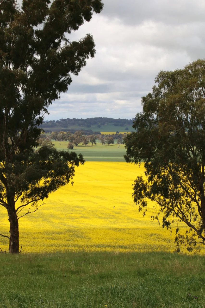
The Dookie district sits within the Goulburn Valley — one of Victoria’s most important agricultural regions supporting food production, livestock systems, edible oils and biofuel feedstocks.
Verified local and industry data show:
Wheat yields: 5–8 tonnes per hectare (dryland), supporting food and livestock feed supply
Canola yields: 3–4 tonnes per hectare, supplying edible oils, livestock meal and biofuel feedstocks
Three local farms have also been selected for GrainCorp NEXT, a national low-emissions canola supply chain program involving only 12 farms Australia-wide, demonstrating the region’s importance to emissions-reduction initiatives already underway.
This land is already contributing to Victoria’s food system and energy transition.
-
The Goulburn Valley supports:
grain and oilseed production
livestock feed systems
food manufacturing
edible oil supply
renewable biofuel feedstocks
Protecting this landscape protects both food security and climate goals. Fragmenting high-performing agricultural land with permanent infrastructure undermines the very systems required for a resilient low-carbon future.
Once this land is compromised, it cannot be replaced or relocated.
-
The Dookie landscape contains known and likely Aboriginal cultural heritage, including:
greenstone and chert outcrops used for tool-making
quarry sites
ancient waterways and prior streams
intact hill country and plains
Current planning relies on Aboriginal Cultural Heritage Sensitivity mapping based on coarse, statewide geological datasets. These datasets do not capture many landscape-scale cultural features present in this region.
Importantly:
The absence of mapped sites does not indicate an absence of cultural heritage
The area has not undergone comprehensive on-ground cultural surveys
Much of the landscape remains relatively undisturbed, increasing the likelihood of undocumented sites
Planning decisions are therefore being made using incomplete cultural information.
-
The proposed REZ footprint overlaps:
Brolga habitat
wetlands and drainage lines
remnant native vegetation
broad floodplain systems across the Dookie plains
Since the decommissioning of historic stock and domestic channels, water now moves more naturally across the landscape. Despite this:
No region-wide floodplain or cumulative hydrology assessment has been completed
The risk of infrastructure blocking or redirecting natural flows has not been fully assessed
These risks directly affect agricultural productivity, ecosystems and downstream communities.
-
Dookie supports a growing visitor economy tied directly to its landscape and unique visual impact, including:
Mount Major Summit Walk
Dookie Rail Trail
spring canola tourism
cycling events
weddings, retreats and regional hospitality
No comprehensive visual impact assessment has been undertaken from Mount Major or other key viewpoints, despite the scale and permanence of proposed infrastructure.
Industrial-scale development would permanently alter this unique landscape valued for its natural character and community amenity.
-
A Greater Shepparton City Council community survey found:
84% of respondents had no opportunity to participate in consultation
74% oppose the current REZ proposal
76% believe the boundary selection process is flawed
These findings indicate a clear failure to meaningfully engage with affected communities.
Reports
Summary.
The evidence shows the proposed Central North REZ:
overlaps a strategic food and energy production landscape
relies on incomplete cultural heritage mapping
lacks comprehensive environmental and floodplain assessment
fails to assess landscape and tourism impacts
has not met expectations for transparent consultation